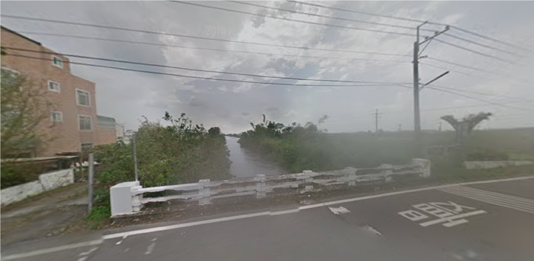
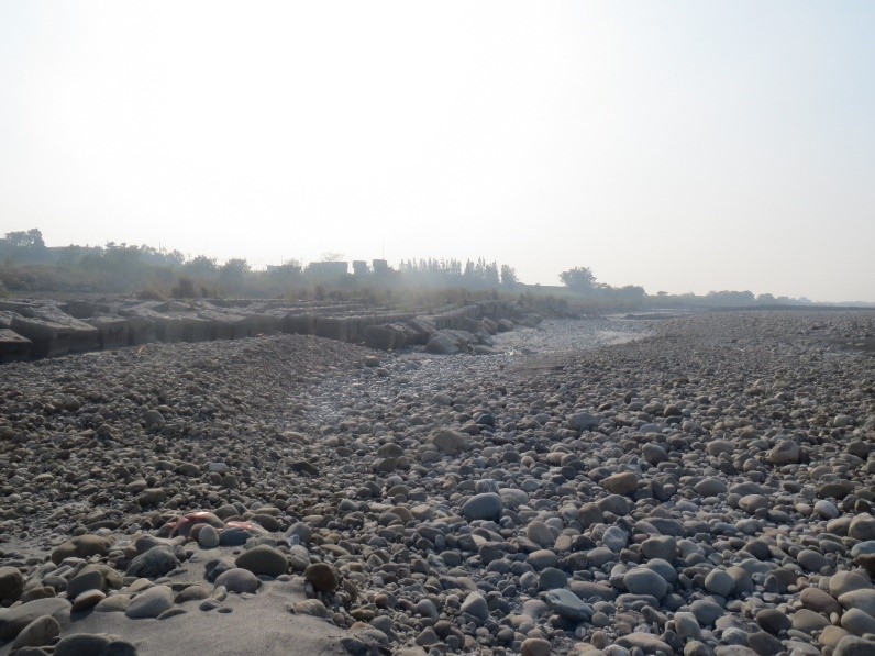
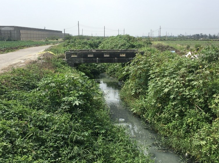
The primary water source for the Zhuo Main Canal irrigation area is drawn from the Zhuoshui River, located in central Taiwan. Originating from the slopes of Hehuanshan in the Central Mountain Range at an elevation of 3,416 meters, the Zhuoshui River is Taiwan’s longest river, stretching 186.6 kilometers and covering a vast watershed area. In its upper reaches, the river flows through mountainous regions, reaching Xinyi Township in Nantou County, where it is joined by tributaries such as the Wanda River, Kashe River, Danda River, Luanda River, Junda River, Shuili River, and Chenyulan River. The riverbed elevation drops to around 300 meters and further decreases to approximately 200 meters in the Jiji Basin. Upstream, near the Ershui Railway Bridge, the river receives additional tributaries, including the Qingshui River and Dongpurui River, before flowing into the Changhua Alluvial Plain and eventually emptying into the Taiwan Strait at Mailiao. The riverbanks are characterized by steep cliffs composed mainly of slate and sedimentary layers. These rock formations are soft, heavily fractured, and prone to rapid weathering, making them susceptible to erosion from heavy rains, typhoons, and earthquakes. This results in frequent landslides and turbid water quality. Along the Zhuoshui River, three intake structures have been established:
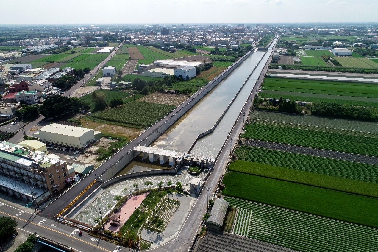
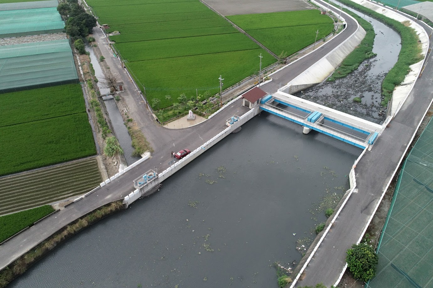
Built in 1972, this intake facility is located downstream of the Zhangyun Bridge on the left bank of the Zhuoshui River, adjacent to the Linnei Second embankment. Locally referred to as the "Linnei No. 2 Sluice Gate" or the "Zhuoshui River Linnei First Intake," it was initially under the Chukou Work Station, which later merged into the Linzhong Work Station. Following the establishment of the Yunlin Irrigation Association in 1975, it was renamed the "Zhuo Main Canal Linnei No. 1 Intake." The original structure featured twelve upper and lower entry openings and six exit openings, with a maximum intake capacity of 54 cubic meters per second (CMS). Constructed from reinforced concrete, the facility included a 10kW generator-operated water control gate, with the bottom elevation of the intake sluice gate set at 90.6 meters. However, in recent years, illegal sand and gravel extraction has severely altered the riverbed, leading to blockages at the intake and rendering it non-functional.
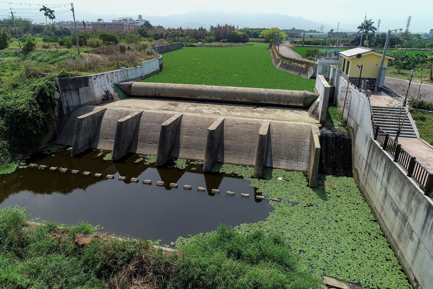
Constructed in 1920, this intake facility is situated approximately 2.5 kilometers downstream on the left bank of the Zhangyun Bridge. The original sluice gate structure comprises ten entry openings on each of the upper, middle, and lower levels, along with ten exit openings on a single level. The front section of the intake gate is equipped with ten electrically operated trash racks and sluice gates, while the rear section features ten electrically operated sluice gates. The bottom elevation of the intake sluice gate is set at 83 meters. In addition, the facility includes four sediment discharge gates, each 36 meters wide, with a bottom elevation of 81.68 meters. The maximum intake capacity of this facility is 54 CMS, and it has a flood discharge capacity of 800 CMS. A 20kW generator is available for use in case of a power outage.
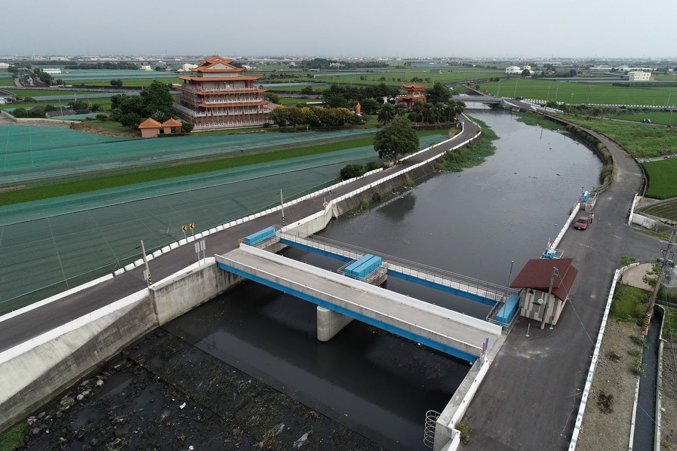
Originally constructed during the Jiaqing period of the Qing Dynasty, this facility was initially known as the "Zhongguozi Sluice Gate" and directly diverted water to supply the Luchangke Canal system in the Xiluo area. In 1903, in conjunction with the construction of the Zhuoshui River embankment, the original facility was upgraded with seven entry openings on each of the upper, middle, and lower levels, utilizing a reinforced concrete hoisting gate. Located beside the Zhuoshui River's Linnei No. 6 embankment, and locally referred to as the "No. 6 Sluice Gate," the facility had a maximum intake capacity of 67.5 CMS. Water diverted through this facility was channeled 1,431 meters into the Luchangke Canal system for irrigation. The intake was later renamed the "Linnei Third Intake." In 1974, as part of government efforts to accelerate rural development, a new intake facility was constructed beside the Linnei No. 4 embankment. This new intake is equipped with six electrically operated trash racks and six electrically operated intake gates, along with two sediment discharge gates, with a total width of 20 meters. The bottom elevation of the intake sluice gates is set at 78.8 meters, and the bottom elevation of the sediment discharge gates is 78.3 meters. The intake capacity is 34 CMS, and the flood discharge capacity is 350 CMS. In addition, a 22.38kW generator is installed for emergency use during power outages. After the Yunlin Irrigation Association was established in 1975, the facility was renamed the "Zhuo Main Canal Linnei No. 3 Intake." The diverted water flows through a 460-meter-long channel into the Zhuo Main Canal.
The Zhuo Main Canal intake originally relied on traditional bamboo weirs to divert water, which were frequently destroyed during heavy rains, leading to substantial annual maintenance costs. Furthermore, severe illegal sand and gravel extraction in the downstream section has caused significant deepening of the riverbed, resulting in frequent loss of intake functionality after heavy rains. After persistent efforts by this office, funds were secured to restore the sediment discharge gates and complete the ground sills.
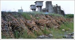
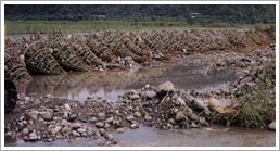
Hydraulic Engineering: Due to the absence of a reservoir, temporary water diversion structures (bamboo weirs) were necessary to divert water from the Zhuoshui River. The construction costs for these structures were substantial, and they were often destroyed during heavy rains.
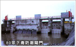
The Zhuo Main Canal irrigation area, managed by this office, is located on the alluvial fan plain of the Zhuoshui River, one of Taiwan's key agricultural regions. Due to the highly uneven seasonal distribution of water resources in the Zhuoshui River basin and the absence of reservoirs for water storage, the coastal areas downstream suffer from severe water shortages. These areas rely solely on groundwater extraction or the reuse of return water from drainage channels. The Niuputou area in Dongshi Township has long experienced severe water shortages. After multiple reviews of the feasibility of reusing return water from the nearby Jiuhuwei River, a plan was developed to install a dam in the Jiuhuwei River drainage system to divert water for dual purposes: irrigation and drainage. After comparing various construction methods, a rubber dam was determined to be the most suitable solution.
- A 25-meter long, 2.5-meter tall rubber dam.
- An energy dissipation facility associated with the rubber dam.
- An operations room and operating equipment for the rubber dam.
- A 1.5-meter wide, 1.2-meter tall water intake gate for the Niuputou supplemental water source.
- Two channel outlet structures.
- Start date: April 1, 1983.
- Completion date: January 25, 1984.
- Civil engineering: NT$5.3 million.
- Electromechanical engineering: NT$5.8 million.
- Total project cost: NT$11.1 million.
- The Old Huwei River drainage system can handle a flood peak flow with a five-year recurrence interval of 132.5 CMS and is also effective in removing pollutants and water hyacinths.
- The Niuputou supplemental water source has a water intake capacity of 1.08 CMS, with water intake occurring annually from June to December.
This rubber dam inflates in about 25 minutes. When the overflow water level exceeds 50 centimeters, the safety valve automatically opens, deflating the dam within approximately 20 minutes, allowing water to flow across completely, thereby maximizing drainage efficiency.
Since its completion in 1984, the Niuputou supplemental water source has consistently maintained a steady flow in the channel. The facility is easy to operate and manage, and with a reliable water supply, it stands as a rare example of excellence among irrigation facilities.
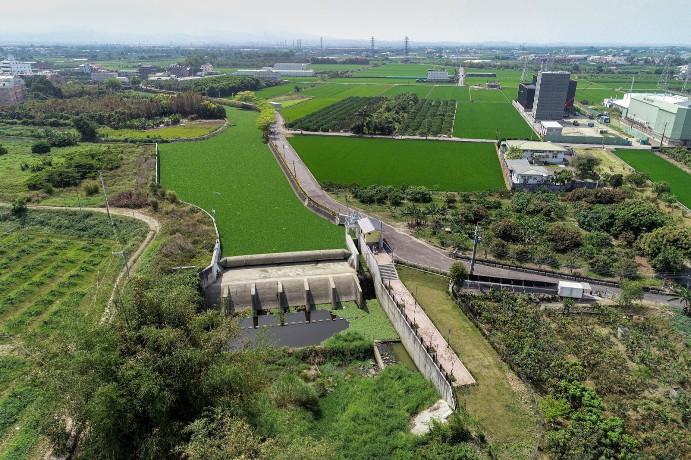
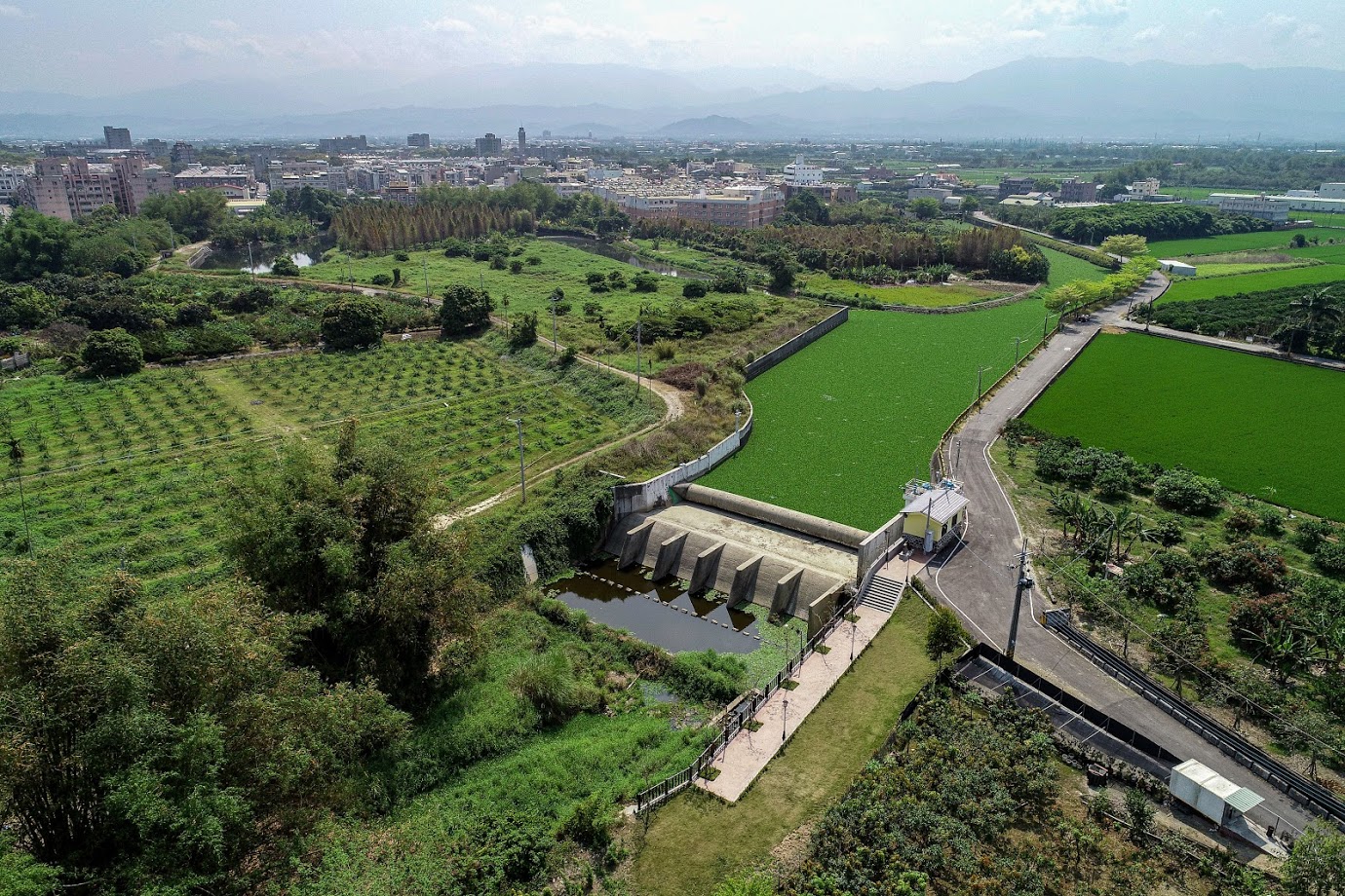
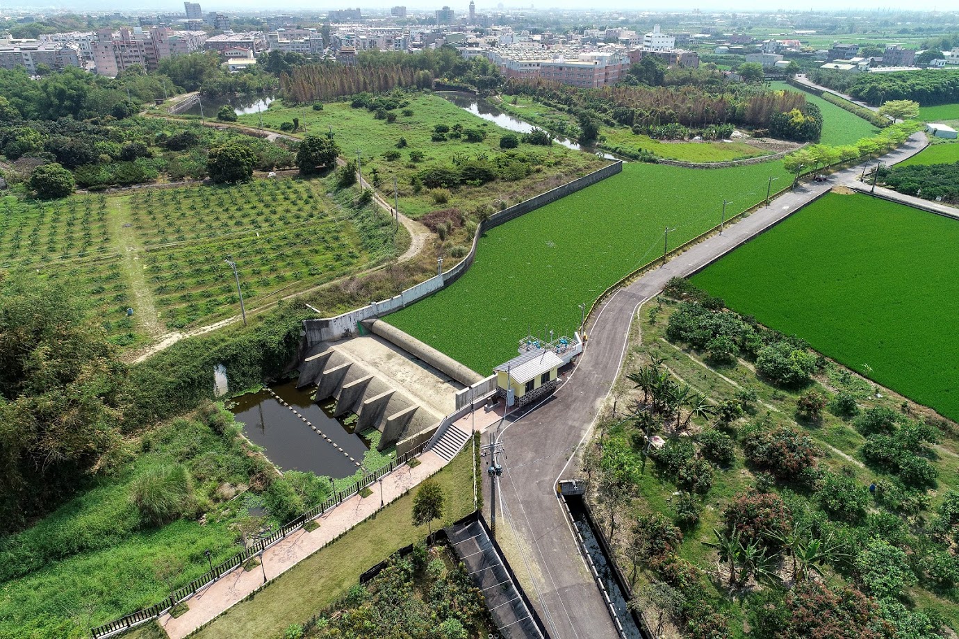
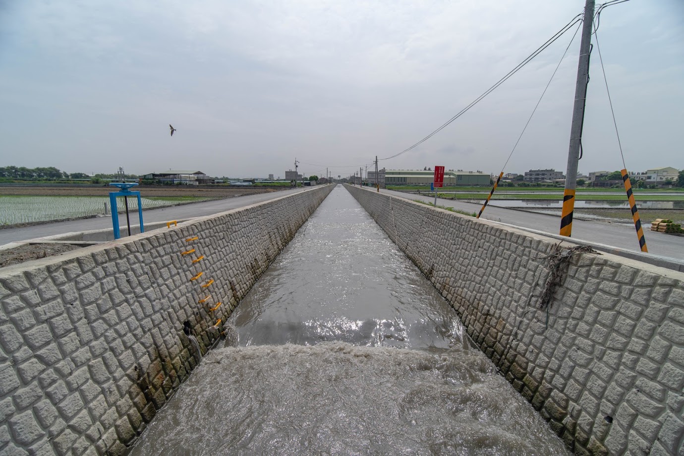
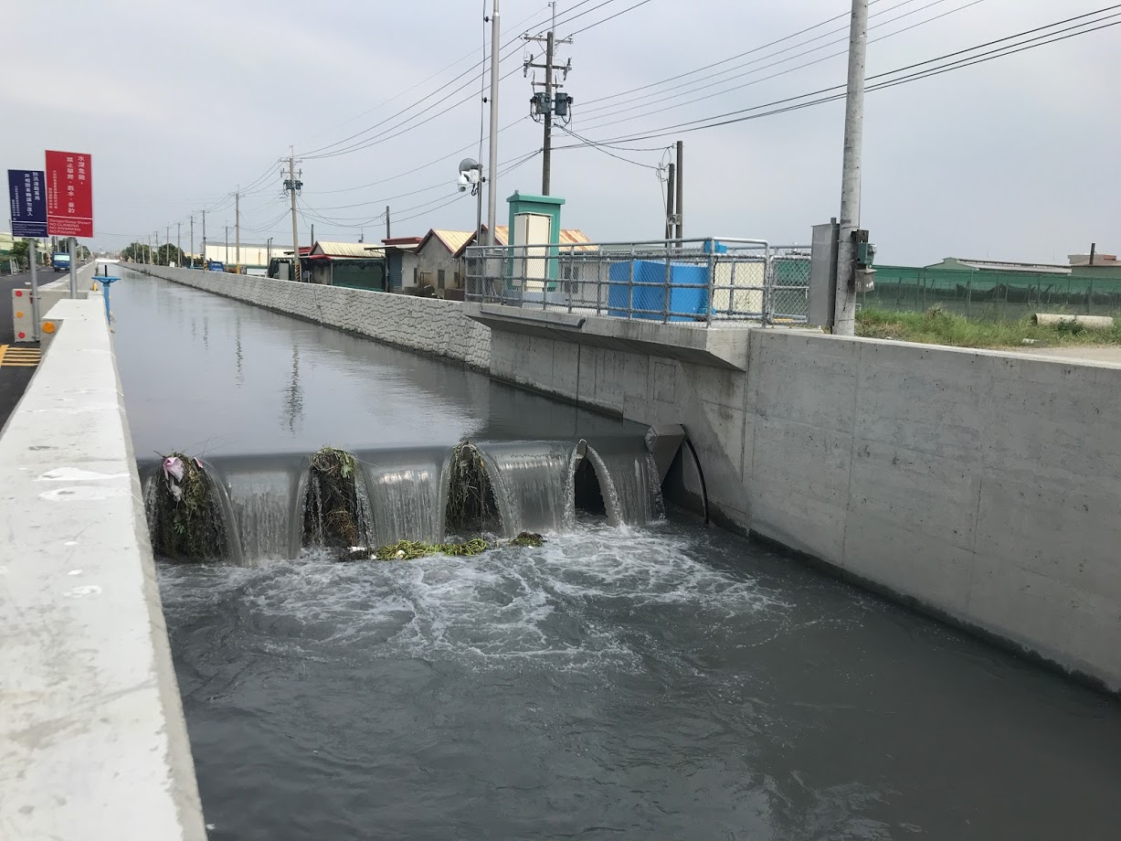
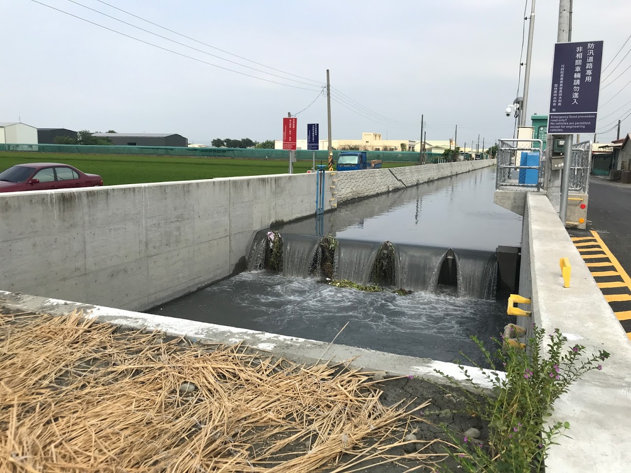
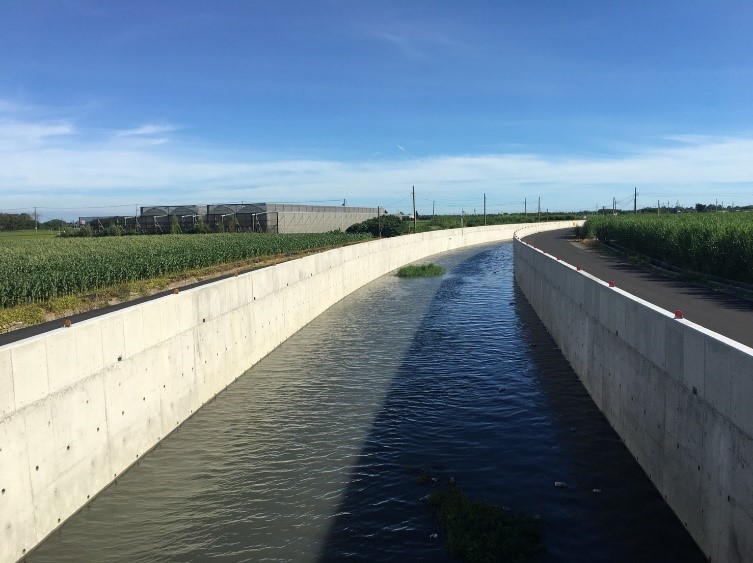
The irrigation area managed by this office is situated in the northeastern corner of the Chianan Plain in central-southern Taiwan, covering over 64,000 hectares. While the region receives an annual rainfall of approximately 1,500 millimeters, the distribution is highly uneven. The rainy season occurs from May to October, while the dry season lasts from November to April of the following year. The main source of irrigation water comes from rivers, following a run-off river irrigation system. Due to the steep gradients and short lengths of these rivers, flow rates fluctuate significantly depending on rainfall, leading to marked differences between periods of high and low water flow. With no reservoirs in the irrigation area, river water often proves insufficient during dry periods, causing intermittent water shortages and an unstable water supply. To mitigate these challenges, the office has actively developed 65 supplementary water sources, primarily through the extraction and reuse of return water. Most of these supplementary water sources are located in unpolluted channels and can be classified into two types based on geographic conditions: gravity-based and mechanical water intake systems. For gravity-based systems, a water diversion structure is installed within the channel to concentrate and elevate the usable water level for easier extraction. However, since these structures must also maintain the channel's original drainage function, the development of automatic tilting sluice gates that balance both irrigation and drainage functions became essential.
Supplementary water sources typically involve the installation of transverse control sluice gates within drainage channels to concentrate and elevate the usable water level. However, because the gate structure and its pillars can impede drainage, an overflow water level is set below the outflow height. When water reaches this predetermined level, the pressure valve automatically opens, causing the sluice gate to tilt down to align with the channel bed, allowing upstream drainage and floating debris to pass smoothly. When water intake is required, the power system is activated to raise the gate, fully optimizing both its irrigation and drainage functions. The design favors wide-span gates, which are highly effective at removing floating debris. The gates are also sealed to prevent water leakage, maximizing the use of limited resources.
This project, focused on regional drainage management, was handed over to the Yunlin County Government in 1997.
- Excessive groundwater extraction is prevalent in the coastal areas of Yunlin County, including Kouhu, Sihu, Shuilin, Taisi, and Mailiao townships, where the total aquaculture area spans approximately 10,700 hectares. This over-extraction has gradually depleted the once-abundant groundwater, leading to progressive land subsidence.
- Coastal aquaculture operators frequently breach embankments or damage tidal gates along various drainage routes to divert seawater for fish pond operations. This practice has rendered the gates, designed to prevent seawater intrusion, ineffective.
- The delayed implementation of drainage improvement plans, coupled with insufficient funding due to the significant costs involved, has hindered necessary upgrades. As a result, drainage systems have been unable to discharge water effectively, leading to frequent flooding incidents.
- Years of neglect have left drainage routes and tidal gates in various states of disrepair.
- Designate specific aquaculture zones and establish a coordinated water supply system.
- Fully utilize surface water sources and implement effective irrigation strategies to replenish groundwater and mitigate land subsidence.
- Strictly enforce land use control regulations.
- Crack down on illegal groundwater extraction.
- Reform aquaculture practices and management.
- Accelerate the construction, repair, and improvement of tidal gates.
Due to severe land subsidence, the tidal reach has extended inland. During heavy rainfall combined with high tides, seawater intrudes, causing backflow. While the long-term solution lies in the implementation of the aforementioned improvement measures, tidal gates should be installed at drainage outlets and manually operated as an immediate solution. These tidal gates must be multifunctional, tailored to their intended use. They should incorporate an automatic drainage feature for normal flow, allowing internal water to discharge naturally when the internal water level is higher than the external level. Conversely, when the external water level exceeds the internal water level, the gates should close automatically. For heavy rainfall events, the gates should be designed to handle the estimated peak flood discharge. When necessary, all gates can be fully opened to maximize flood relief capacity. Additionally, as modern aquaculture relies on seawater, seawater intake gates and channels should be installed according to local needs and practices. These facilities must meet the daily seawater exchange requirements of the aquaculture industry, with water flow calculated accordingly.
The Houzhuangzi Pond irrigation facility, managed by the Douliu Work Station under the Douliu Management Office of the Taiwan Yunlin Irrigation Association, is located downstream of Longtan Bridge on the Bajiao Creek (Datan Drainage) in Douliu City. Covering an irrigation area of 362 hectares, it is one of the most significant agricultural irrigation ponds in the Douliu region. Established in 1927, the pond had been in operation for 89 years. However, the existing water control facilities had become outdated, with central piers obstructing water flow and causing debris accumulation, which increased flood risks by raising water levels, reducing the cross-sectional area for water flow, and lowering the embankment's outflow height. Additionally, these facilities and structures interfered with the planned river management elevations and embankment lines. Extreme weather events, including heavy rainfall and flooding, exacerbated the drainage issues, leaving the Longtan community in Douliu City vulnerable to inadequate drainage. After repeated petitions from local residents and representatives, the project to improve the water control gate was initiated to ensure smooth water intake and safeguard public property. This project received the Excellence Award in the 2017 Agricultural Construction Engineering Awards.
The Dayilun First Sluice Gate, managed by the Dayilun Work Station under the Xiluo Management Office of the Yunlin Irrigation Association, is located approximately 232 meters downstream of the confluence of the Xiluo Main Drainage, Jiudingpitou Main Drainage, and Gancuo Main Drainage (Yumin No. 1 Bridge). The irrigation area covers 1,064 hectares. The original sluice gate, completed in 1986, had been in operation for 32 years. However, due to aging facilities and structures, it became a bottleneck for flood discharge in the upstream river section, leading to flood hazards such as elevated water levels, reduced cross-sectional area for water flow, and decreased embankment outflow height. In recent years, climate change has intensified the effects of heavy rains and typhoons, complicating drainage in the area. The existing water storage and flood retention system was no longer adequate. After repeated petitions from local residents and representatives, the project to improve the sluice gate was undertaken to ensure efficient drainage and protect public property. Upon completion, the project significantly enhanced flood mitigation, reducing the flooded area by approximately 514 hectares. This project received an Honorable Mention in the 2018 Outstanding Agricultural Construction Engineering Awards.
The Xindingpitou (New Dingpitou) Main Drainage, managed by the Xiluo Work Station under the Xiluo Management Office of the Yunlin Irrigation Association, serves as the agricultural drainage for the upstream area of the Jiudingpitou (Old Dingpitou) Main Drainage (4K+311), with a catchment area of 883 hectares. To meet irrigation needs, two sluice gates were installed on the Xindingpitou Main Drainage, providing irrigation for a total area of 81.25 hectares. The second sluice gate, completed in 1966, had been in operation for 53 years. However, due to the aging of the existing gate facilities and structures, it became a bottleneck for flood discharge in the upstream river section, leading to flood risks such as elevated water levels, reduced cross-sectional area for water flow, and lowered embankment outflow height. In recent years, climate change has intensified the effects of heavy rains and typhoons, complicating drainage and causing multiple embankment breaches in the area. As a result, the existing water storage and flood retention system became insufficient. After repeated petitions from local residents and representatives, a project to improve the drainage channels and water control gates was undertaken to ensure effective drainage and protect public property. This project received the Excellence Award in the 2019 Outstanding Agricultural Construction Engineering Awards.
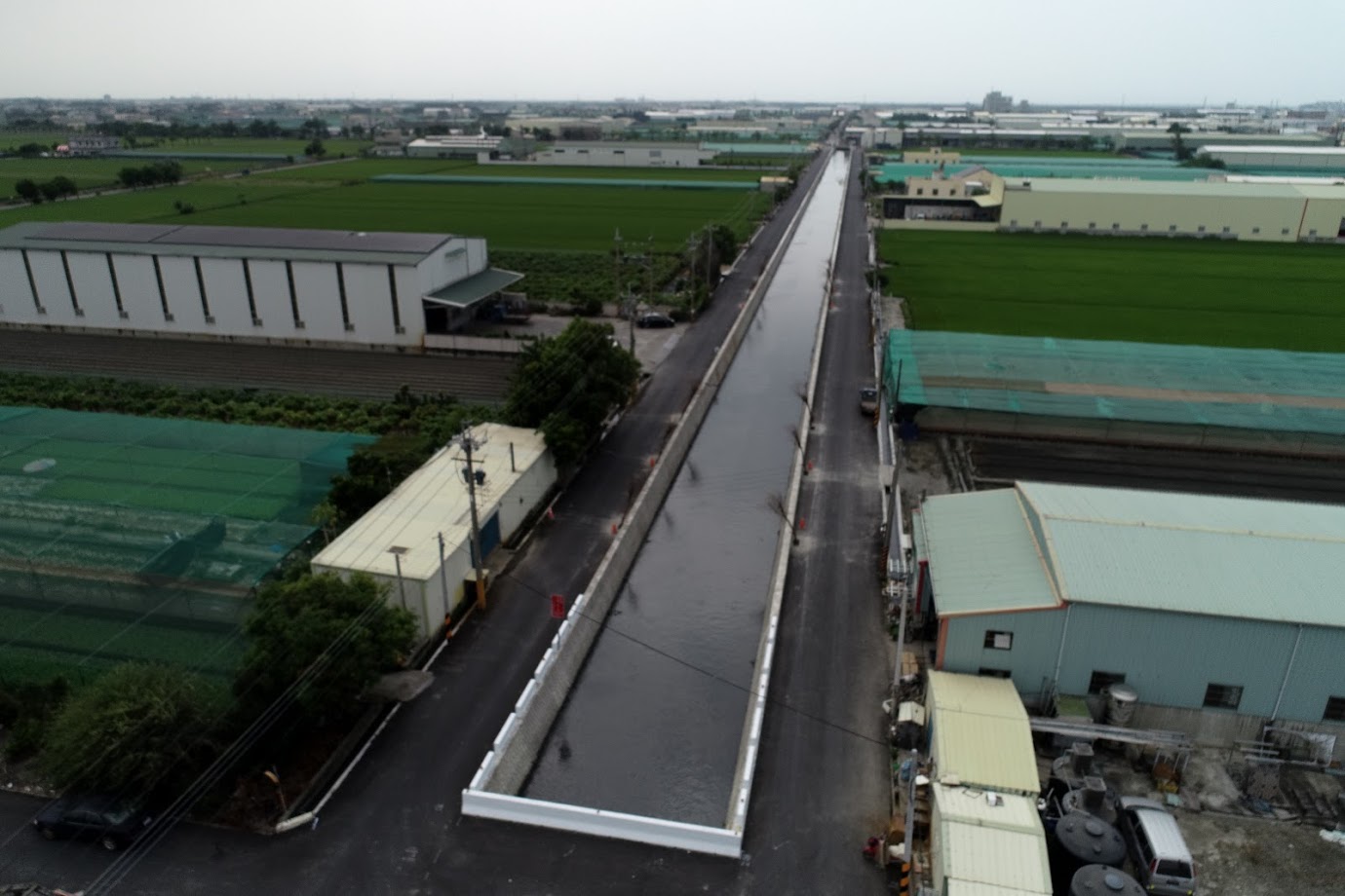
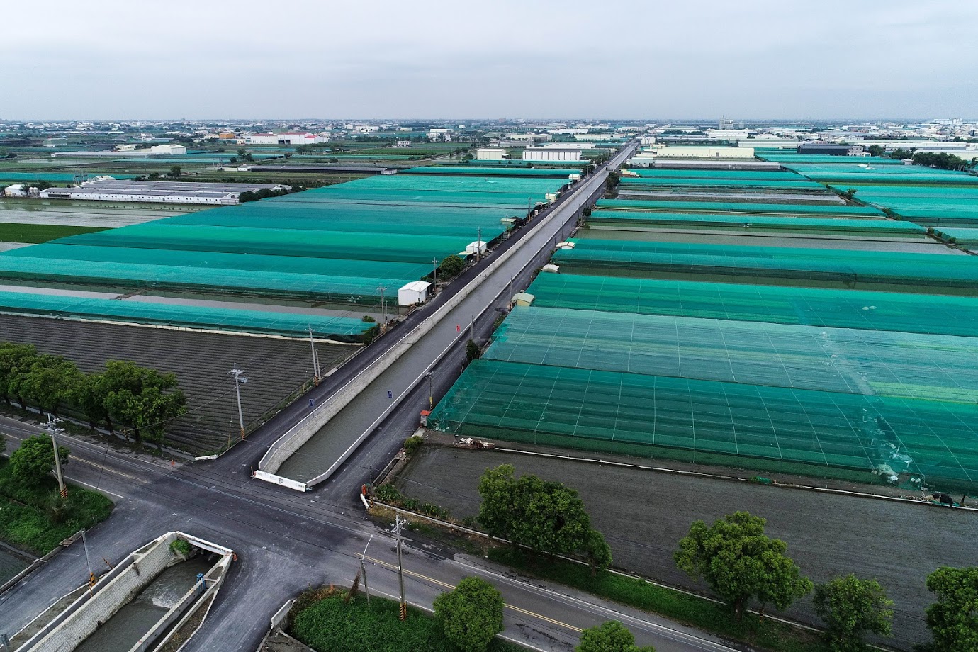
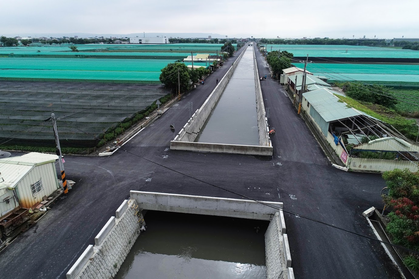
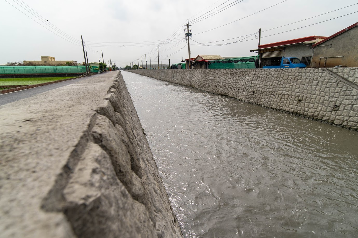
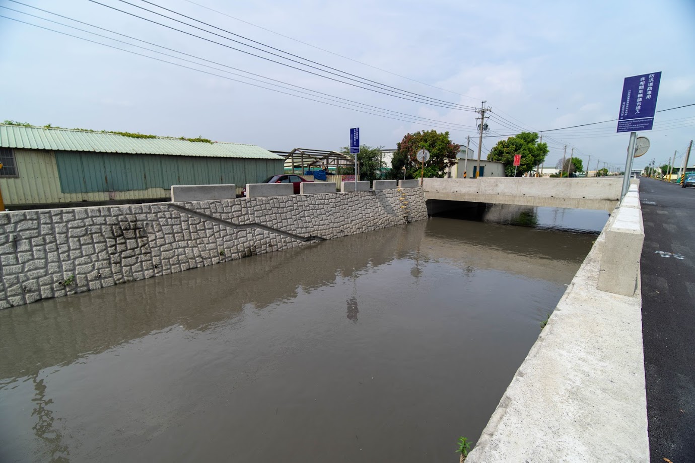
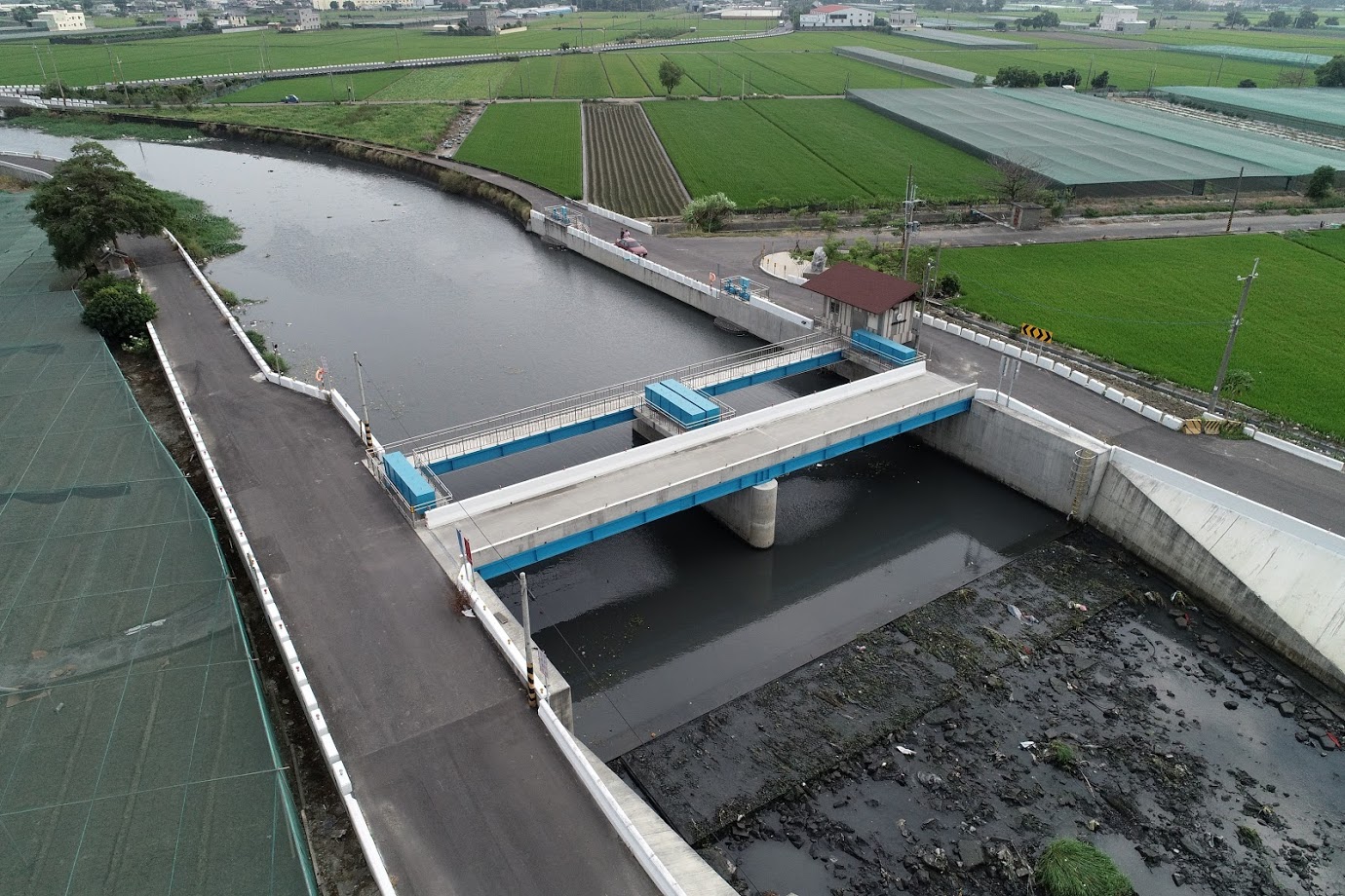
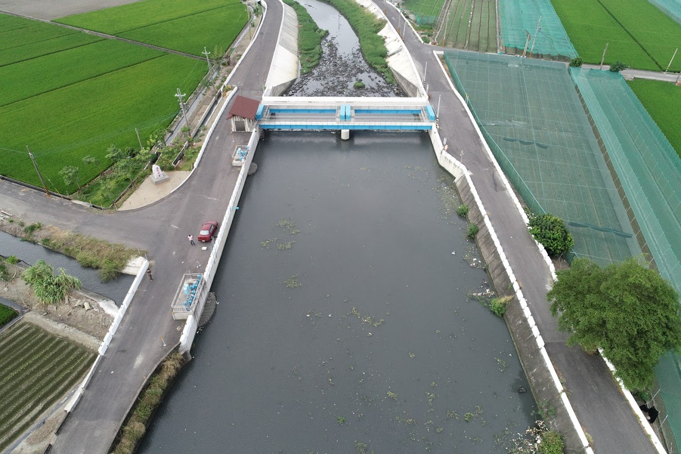
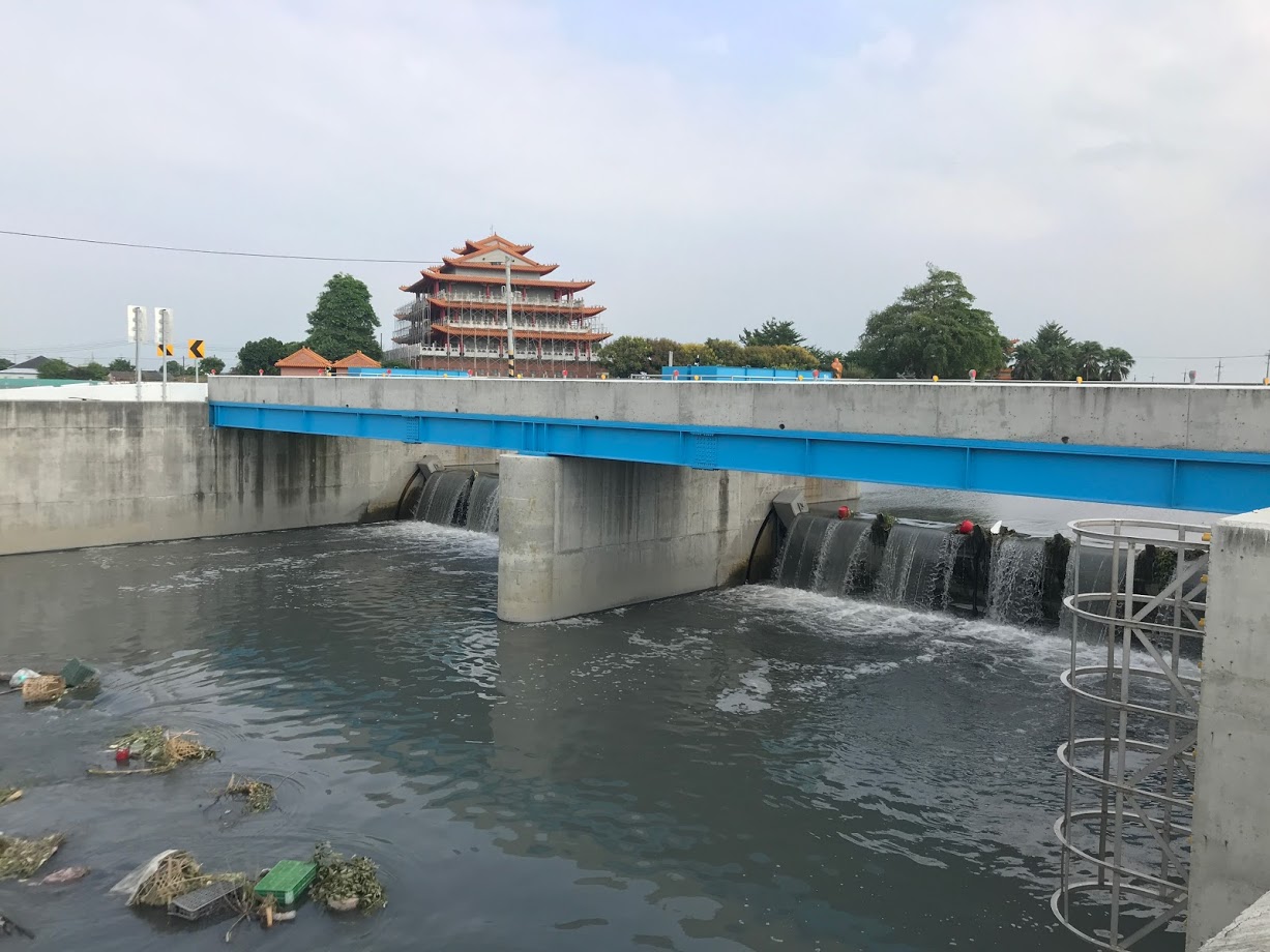
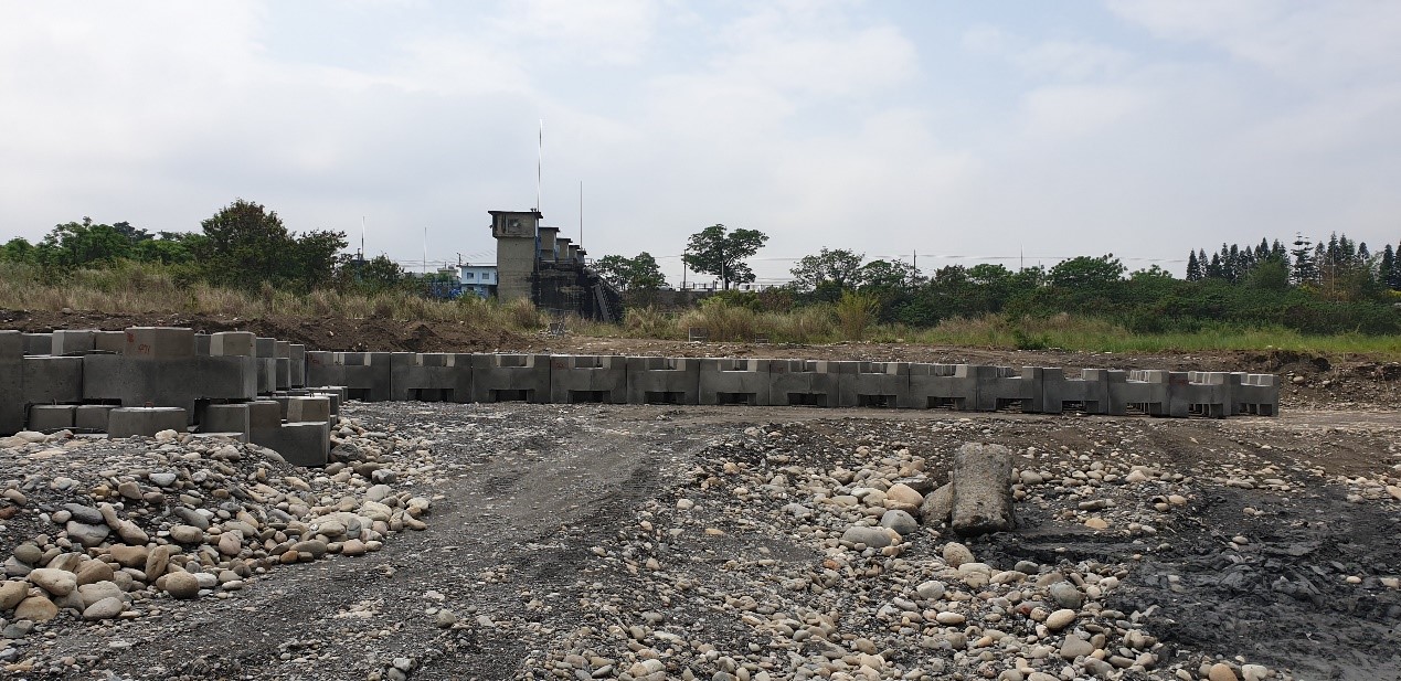
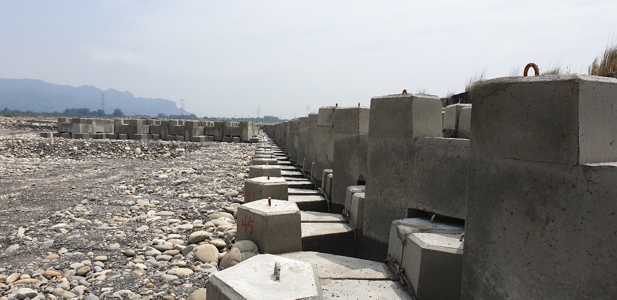
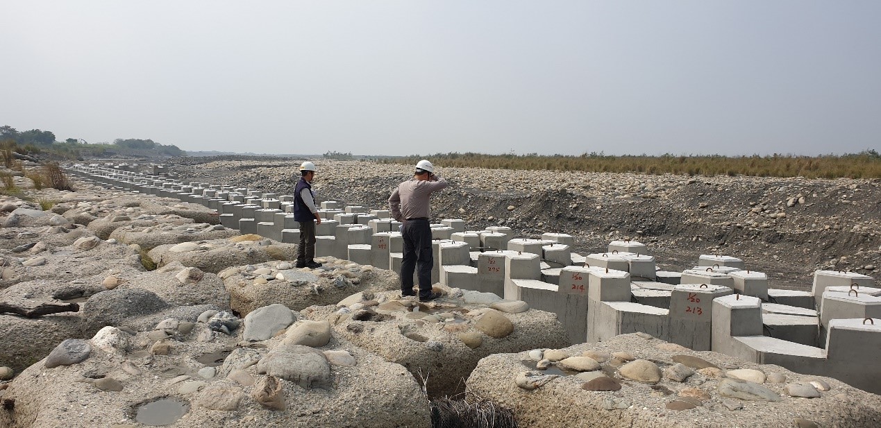
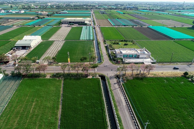
The Zhuo Main Canal’s Linnei No. 2 Intake is a crucial irrigation water intake facility managed by the Yunlin Management Office of the Irrigation Agency. It is located approximately 2 kilometers downstream of the Zhangyun Bridge (on the left bank of the 85th river section of the Zhuoshui River). This intake facility channels water from the Zhuoshui River into the diversion works in Linnei (Bagua Pond), providing irrigation water for 46,000 hectares of farmland under the jurisdiction of the Yunlin Management Office. In late August 2019, Typhoon Bailu struck Taiwan, causing the Zhuoshui River to flood and alter its course, significantly damaging the ground sills of the leading canal at the intake and impairing its functionality. To ensure a stable water supply for irrigation, the Council of Agriculture provided special funding for disaster reconstruction, aimed at stabilizing the river and securing the water source.
This reconstruction project was undertaken to prevent the erosion-prone high riverbank from retreating toward the front of the Zhuo Main Canal’s Linnei No. 2 Intake. A series of spur dikes were pre-installed at vulnerable locations along the high riverbank to redirect the flow after impacting specific points, thereby preventing continued erosion and lateral collapse. These permeable and vertical spur dikes were installed on the riverbank adjacent to the Zhuo Main Canal’s Linnei No. 2 Intake, with lengths ranging from 18 to 20 meters, heights from 2.91 to 2.9 meters, widths of approximately 12.8 meters, and intervals of 45 to 50 meters between the dikes. The scouring depth at the spur heads ranged between 1.31 to 2.92 meters. This effectively redirected the Zhuoshui River’s flow towards the center of the river, protecting the Linnei No. 2 Intake and safeguarding the irrigation water intake facilities.
The Qingpu Main Drainage, under the jurisdiction of the Taisi Work Station, is an important tributary of the Magongcuo Main Drainage, with a catchment area of approximately 689 hectares and a total length of 4.8 kilometers. The channel was originally an earthen ditch, overgrown with weeds, leading to high annual dredging costs. However, the effectiveness of the dredging was minimal, as the cleared channel would remain free of weeds for only 1 to 2 months before becoming overgrown again. In addition, the original channel cross-section was too small, resulting in insufficient flow capacity. During heavy rains, inadequate drainage often caused flooding in local farmlands. The downstream section, approximately 3 kilometers long, had already been improved by the Yunlin County Government and this office over the years (from 1+768 to 4+812). This project aimed to extend these improvements upstream. After multiple funding requests to the Council of Agriculture, the project was carried out in three phases with a budget of approximately NT$160 million.
Upon completion, the project met the farmland drainage protection standard recommended in the "Flood-prone Area Management Plan – Farmland Drainage," which requires the drainage of a one-day rainfall volume with a 10-year return period within 24 hours. The improved channel has a larger cross-section, which can lower water levels in the main drainage during heavy rains, thereby reducing farmland flooding. The enhanced design also significantly reduces maintenance costs. After dredging, the channel now maintains its effectiveness for over a year, demonstrating remarkable efficiency.
The Nansanhe Intermediate Drainage, managed by the Jiulong Work Station under the Xiluo Branch of this office, serves as agricultural drainage for the mid-upper reaches of the Xinhuwei River, covering a catchment area of 298.52 hectares. The existing channel, constructed with masonry, had deteriorated over time. This channel also plays a crucial role in regulating the irrigation water for a branch line of the Xinhuwei River at its starting point. As a result, it frequently accumulated silt and became overgrown with weeds, reducing its flow capacity and drainage efficiency. During heavy rains, this led to delayed drainage in the surrounding fields.
To enhance drainage efficiency, expand the flood discharge capacity, safeguard lives and property, and mitigate disaster risks, this office repeatedly applied for funding from the Council of Agriculture. These efforts eventually secured financial support through the 2019 Forward-Looking Infrastructure Development Program. With a budget of approximately NT$25 million, the project focused on upgrading the existing drainage channel.
Upon completion, the Nansanhe Intermediate Drainage, which also regulates irrigation water for the Xinhuwei River’s branch line, can now efficiently discharge excess water or silt during typhoons, heavy rains, or emergencies. The comprehensive improvements to the channel have significantly enhanced overall drainage efficiency in the area, reducing flood damage and supporting vegetable and rice production in the Erlun area. Additionally, the road was widened, and the uneven AC pavement was completely removed and resurfaced, resulting in a clean, well-maintained drainage path and smoother roads. This has improved the living environment and increased transportation convenience for local residents.
In alignment with government policy, the irrigation wells in the Anqing Canal irrigation area, managed by this Irrigation Association, were sealed, cutting off the main water supply, which had previously relied on groundwater extraction. As a result, the construction of a storage pool along the Zhuo Main Canal was deemed necessary to store off-peak nighttime water for irrigation use. The Zhuo Main Canal Storage Pool, with a capacity of approximately 95,000 tons, and the Anqing Canal Storage Pool, with a capacity of 20,000 tons, were constructed on the left bank of the Zhuo Main Canal using surplus irrigation land. Together, these pools store water during off-peak night hours, providing a combined storage capacity of 116,000 tons. This volume is sufficient to meet the maximum daily water demand of the Anqing Canal irrigation area for approximately two days during the first crop season. The project was completed in four phases, with the "Zhuo Main Canal Storage and Detention Basin Project" being the final phase. Upon completion, the project not only enabled more efficient use of water resources but also provided a recreational area for the local community.